





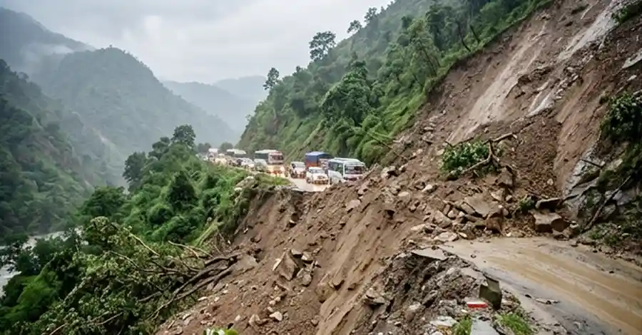
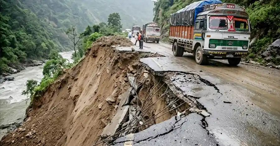
A fresh wave of landslides has struck the Karnali Highway, Nepal’s lifeline road connecting Surkhet with the remote mountain district of Jumla, leaving several stretches of the route completely impassable. Relentless monsoon downpours since Sunday evening triggered multiple landslip events along different segments of the highway, damaging the road surface, halting vehicle movement, and stranding travelers across Karnali Province.
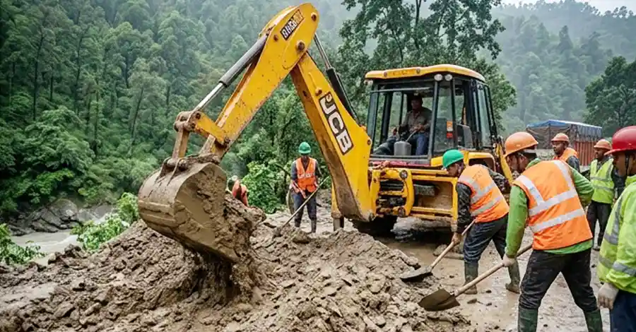
The District Administration Office, Jumla, confirmed that although excavators and labor crews have already been mobilized to clear debris and patch damaged sections, a full reopening of the highway is unlikely within the next day or two. Officials say the combination of unstable slopes, continuous rainfall, and structurally weakened sections of the road make it too risky to promise a quick fix.
This is not an isolated incident. The Karnali Highway, which links Surkhet, Dailekh, Kalikot, Jumla, and Mugu, has become one of Nepal’s most landslide-prone and accident-heavy roads during every monsoon season, and this latest blockage adds to a long, troubling pattern that has plagued the corridor for years.
What Triggered the Karnali Highway Landslide This Time
According to the Chief District Officer (CDO) of Jumla, Tej Prakash Prasai, continuous monsoon rainfall loosened soil and rock along multiple vulnerable points of the highway, causing debris, mud, and boulders to slide onto the carriageway. The blockages began building up from Sunday evening and worsened overnight as rain continued through the district.
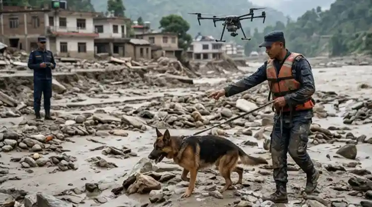
Prasai explained that road-clearing operations are underway in close coordination with the Road Division Office, security agencies, and local authorities, with heavy machinery and additional workers deployed to the worst-hit points. However, he cautioned that some sections of the road itself have been structurally damaged — not just covered in debris — meaning that even after the loose material is cleared, engineering repairs will still be required before the highway can safely reopen to full traffic.
Officials also warned that the danger is far from over. Because rainfall is expected to continue intermittently, there remains a real risk of secondary landslides even in sections that have already been cleared once. This makes the restoration timeline unpredictable and means the highway could face repeated, short-term closures even after crews reopen it.
Why the Timeline for Reopening Remains Uncertain
Unlike a simple debris removal job, this landslide event has left certain points of the highway structurally compromised. In some places, the underlying road base has washed away or cracked, and continuous rockfall from slopes above the highway is making it dangerous for workers and machinery to operate for extended periods. The district administration says weather conditions will heavily influence how quickly the road can be restored, since further rain could easily undo hours of clearance work in a matter of minutes.
Where Exactly Is the Karnali Highway Blocked?
While the current landslide has affected “various sections” of the highway broadly between Dailekh and Jumla, the Road Division Office, Jumla says the stretch from Dahikhola in Dailekh to Khalanga, the Jumla district headquarters, is particularly vulnerable this monsoon. This corridor has repeatedly seen landslides in recent years at well-known trouble spots, including Gaganekhola, Pili, Molpha, and the “S-bend” (Es Mod) sections of the highway — all locations that have made headlines for road blockages in past monsoon seasons.
This recurring geography is not a coincidence. Much of the Karnali Highway runs along steep, geologically unstable slopes above the Karnali River, particularly through Dailekh and Kalikot, where the road has been repeatedly hit by debris flows and mudslides in recent months. In fact, other major blockages have hit the same broad corridor multiple times this year alone, including a landslide at Gagane Khola in Kalikot’s Shubh Kalika Rural Municipality that completely shut the Surkhet-Jumla road overnight, and an earlier blockage at Chaukhola that stranded dozens of vehicles and hundreds of passengers travelling to and from Mugu, Jumla, Kalikot, and Surkhet, as reported by myRepublica.
Passengers and Cargo Vehicles Left Stranded Along the Highway
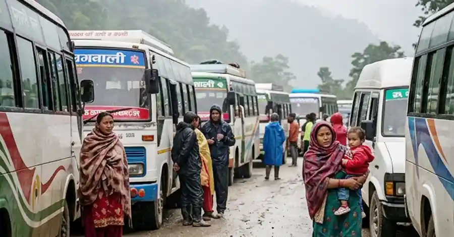
The blockage has hit ordinary travelers and transport operators hard. With the highway cut off, passenger buses, jeeps, and cargo trucks moving between Jumla and other Karnali districts and Surkhet have been forced to halt mid-journey, leaving both drivers and passengers stuck at unpredictable points along the route.
The District Administration Office has urged the public not to attempt travel on the highway without first confirming the current status of the road. Officials warn that vehicles which set out without updated information risk becoming stranded in the middle of remote, landslide-prone terrain, far from any town, shelter, or emergency services — a scenario that has played out repeatedly on this highway during past monsoon seasons.
CDO Prasai has specifically requested that transporters and cargo operators coordinate directly with the Road Division Office, Jumla before dispatching vehicles, so that drivers know exactly which sections are open and which remain blocked. This kind of coordination, officials say, is the only way to avoid a repeat of past incidents where trucks and buses were trapped for one or two nights on the highway, some 3,000 meters above sea level, with limited access to food, warmth, or medical help.
The Human Cost of Highway Closures in Remote Karnali
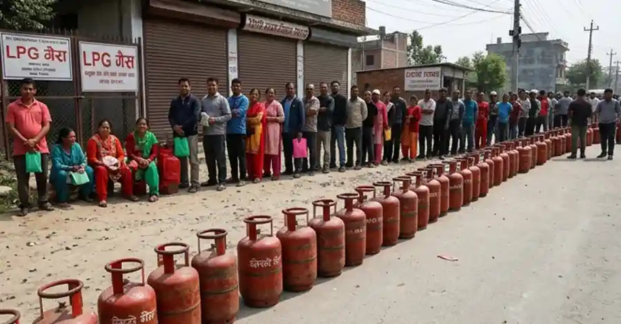
For residents of far-western and Karnali Province districts, the Karnali Highway is not a convenience road — it is often the only surface route connecting isolated mountain communities to markets, hospitals, and administrative centers in Surkhet and beyond. When it closes, essential supplies, medicine, cooking gas, and even ambulances face serious delays. Passengers traveling for medical treatment, school admissions, or family emergencies are among those most affected by prolonged closures, particularly in a district like Jumla, which has limited alternative transport options.
Local Economy Feels the Squeeze: Apple Traders Among the Hardest Hit
Beyond passenger inconvenience, the timing of this landslide season is especially painful for Karnali’s agricultural economy. Jumla, Mugu, and Humla are currently in the peak harvest season for apples, one of the region’s most valuable cash crops, with truckloads of fruit typically transported daily to major markets including Surkhet, Nepalgunj, Butwal, Chitwan, Pokhara, Kathmandu, and Birgunj.
According to a report from Khabarhub, earlier this season similar landslide-driven closures along the Jumla-Kalikot-Dailekh stretch left apple-laden trucks stranded for days, raising fears among traders that the fruit could spoil before reaching buyers. With roughly 19,500 metric tonnes of apples produced this season and about half already exported at the time of that report, prolonged highway disruptions translate directly into financial losses for farmers and transporters who depend on a narrow window to move perishable produce out of the region.
This latest blockage threatens to repeat that pattern, once again squeezing an agricultural supply chain that already operates on thin margins and unpredictable road conditions.
A Recurring Nightmare: Why the Karnali Highway Keeps Collapsing Every Monsoon
This week’s landslide is far from a one-off disaster — it is the latest chapter in a persistent, multi-year crisis on what has become known as one of Karnali Province’s most dangerous roads. Local officials openly acknowledge that the same sections are repaired, damaged again, and repaired once more, year after year, in an exhausting and expensive cycle.
A History of Repeated Blockages
Over the past several monsoon seasons, the Surkhet-Jumla corridor has been blocked repeatedly at recurring hotspots. A landslide at Gagane Khola blocked the highway for roughly 19 hours in one recent incident, according to OnlineKhabar English News, while a separate landslide at Chaukhola in Kalikot brought traffic to a complete halt and stranded thousands of passengers along with dozens of vehicles carrying essential food supplies, as reported by Nepal News. In yet another incident, heavy rain triggered a landslide that killed a young woman while she was traveling along the highway near the Dailekh-Kalikot border, highlighting the fatal risks the road poses even outside major, headline-grabbing blockages.
Poor Construction Quality Compounds the Landslide Risk
The recurring landslides are only part of the story. According to an in-depth investigation by The Kathmandu Post, the Karnali Highway was blacktopped using Otta Seal technology in fiscal year 2019-20 with roughly Rs 1 billion in World Bank funding, covering 126 kilometers from Surkhet to Khidkijhyula and another 107 kilometers onward to Jumla. Yet despite this investment, around 80 percent of that blacktop surface has already peeled away.
Nearly Rs 670 million has reportedly been spent on highway maintenance over just the past three fiscal years, with the Road Division Offices in Surkhet and Jumla allocating tens of millions of rupees annually simply to keep the road passable. Local officials quoted in that report candidly describe a frustrating cycle: crews repair one landslide-damaged section, only for a new slide to strike the very same spot the following year, forcing the same money to be spent over and over on identical stretches of road.
Safety infrastructure has suffered too. Protective roadside barriers, meant to prevent vehicles from sliding into the Karnali River along the highway’s many cliffside sections, have been damaged by falling rocks and landslides, with many left in a deteriorated state. Drivers who have used the route for over a decade say the loss of these barriers has made an already nerve-wracking journey feel even riskier, particularly on stretches where the road hugs steep drops above the river.
The scale of danger on this highway is stark: provincial police data cited in Nepali-language reporting indicates the Karnali Highway alone accounts for a disproportionately high share of all road accidents recorded across the province, with hundreds of fatalities linked to the corridor over the past decade.
Why the Terrain Makes This Highway Especially Vulnerable
Geologically, the Karnali Highway cuts through steep, young mountain terrain in Nepal’s mid-hills, where slopes are prone to erosion, especially where forest cover has thinned or road-cutting has destabilized natural hillsides. Add in Nepal’s intense monsoon rainfall — often concentrated into short, heavy bursts — and the result is a highway corridor where landslides are not an occasional hazard but an almost predictable seasonal event. Engineers and local officials alike have pointed out that until slope stabilization, proper drainage systems, and durable retaining structures are built at known hotspots, temporary debris clearance will only ever be a short-term fix.
The Bigger Picture: Nepal’s Brutal 2026 Monsoon Season
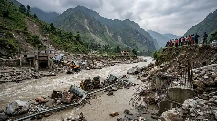
This landslide in Jumla comes during what has already been an unusually devastating monsoon season for Nepal as a whole. Earlier this year, a catastrophic flash flood along the Bhote Koshi River in Rasuwa District — triggered by a massive glacier collapse near Langtang Lirung — caused widespread destruction across northern Nepal and into the Tibet Autonomous Region of China. According to ongoing tracking by Wikipedia’s coverage of the 2026 Nepal floods, that disaster alone resulted in well over a thousand confirmed deaths in Nepal and thousands more reported missing, with Nepal’s National Disaster Risk Reduction and Management Authority (NDRRMA) estimating losses of around Rs 400 billion.
The United Nations Development Programme has also been directly involved in the response, with UNDP Nepal supporting data coordination, damage assessment, and early recovery planning following the Bhote Koshi disaster. These events underscore a broader pattern: 2026 has been an exceptionally hazardous monsoon year for Nepal, with landslides, flash floods, and infrastructure damage reported across multiple provinces, not just in the remote Karnali region.
Seen against this backdrop, the Karnali Highway landslide in Jumla is a smaller, localized event, but it reflects the same underlying vulnerability that has made this monsoon season so damaging nationwide: steep terrain, intense rainfall, weak infrastructure, and roads that were never built to withstand repeated, severe weather stress.
Safety Advisory: What Travelers and Transporters Should Do
Given the current situation, the District Administration Office, Jumla, along with the Road Division Office and local security agencies, have issued clear guidance for anyone planning to use the Karnali Highway in the coming days:
- Do not travel without first confirming road status. Contact the Road Division Office, Jumla, or local police before setting out, especially for long-distance journeys.
- Avoid night travel through known landslide zones such as Gaganekhola, Pili, Molpha, and the Es Mod section, where visibility is poor and rockfall risk is highest after dark.
- Cargo and freight operators should hold shipments until official confirmation that the relevant section of highway has reopened, rather than risking vehicles becoming stranded mid-route.
- Watch for secondary landslide risk even in areas that have already been cleared once, since continued rainfall can trigger repeat slides on the same slopes.
- Keep emergency contacts and warm clothing on hand if travel is unavoidable, given the possibility of unexpected delays in remote, high-altitude sections of the route.
Officials have been especially direct in warning that pushing vehicles forward into partially cleared sections — simply to save time — has repeatedly led to travelers getting trapped mid-route in past incidents on this same highway.
What Happens Next for the Karnali Highway
CDO Prasai says coordination between the Road Division Office, the District Administration Office, and security agencies is ongoing, with debris clearance work being treated as a top priority. Once weather conditions stabilize and the most severely damaged sections are repaired, authorities expect traffic to gradually return to normal — though officials have stopped short of giving an exact date, citing the unpredictable nature of monsoon rainfall in the region.
For long-term relief, however, local officials and independent reporting both point to the same underlying need: sustained investment not just in emergency debris clearance, but in proper slope stabilization, drainage infrastructure, and road engineering along the Karnali Highway’s most chronically unstable stretches. Without that deeper investment, the pattern seen this week — and in similar incidents throughout past monsoon seasons — is likely to repeat itself again next year.
Frequently Asked Questions About the Karnali Highway Landslide
1. Why is the Karnali Highway blocked right now? Heavy, continuous monsoon rainfall triggered landslides at multiple points along the highway between Dailekh and Jumla, damaging the road surface and blocking vehicle movement since Sunday evening.
2. How long will it take to reopen the Karnali Highway? The District Administration Office, Jumla, says full reopening could take several days, since some sections of the road itself have been structurally damaged, not just covered in debris, and continued rain could trigger further landslides.
3. Which sections of the highway are most affected? The stretch between Dahikhola in Dailekh and Khalanga in Jumla is considered especially high-risk this monsoon, including well-known hotspots like Gaganekhola, Pili, Molpha, and the Es Mod section.
4. Is it safe to travel on the Karnali Highway right now? Officials strongly advise against travel without first confirming the road’s status with the Road Division Office, Jumla, or local police, due to the risk of vehicles becoming stranded or hit by secondary landslides.
5. Why does the Karnali Highway experience landslides so frequently? A combination of steep, unstable mountain terrain, intense monsoon rainfall, and long-standing road construction and maintenance issues — including rapidly deteriorated blacktop surfacing — makes this highway especially prone to recurring landslides every monsoon season.
6. Who should I contact for the latest road status? Travelers are advised to contact the Road Division Office, Jumla, or the District Police Office for updated, location-specific information before beginning a journey on the highway.
Final Word
The latest Karnali Highway landslide is a stark reminder of just how exposed Nepal’s remote mountain districts remain to monsoon hazards, and how thin the margin is between a passable road and a cut-off community. As debris-clearing crews race against continuing rainfall to reopen the Surkhet-Jumla corridor, residents, traders, and travelers across Karnali Province are once again left waiting — and hoping that this year’s repairs hold longer than the last.

Economic Affair
- Budhigandaki Flood: 47 Rescued as Bridges Washed Away
- Nepal Supreme Court Handcuff Order: Police Barred From Routine Use
- 250+ Officials Deploy to Assess Rasuwa-Bhotekoshi Flood Damage
- Electricity VAT: Energy and Finance Ministers Strike Landmark Deal After Just 2 Months
- Nepal Inflation Shockingly Triples to 5.96% — Food and Transport Hit Hardest




Comments