
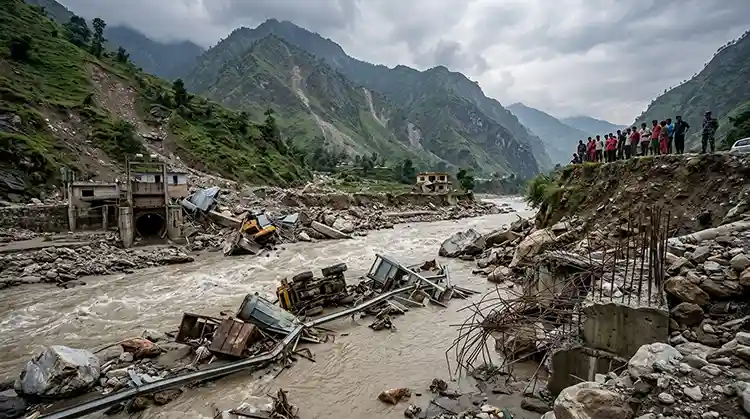


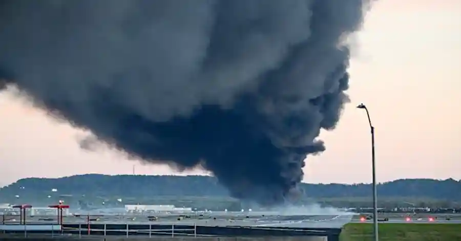




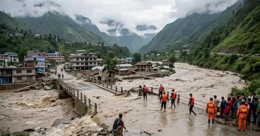
A wall of ice, rock, and mud with the destructive force of three atomic bombs roared down a Himalayan valley in under 30 minutes — and by the time it stopped, an international border crossing, a national dry port, and thousands of lives had been swept away. The Rasuwa flash flood of August 26, 2026, is now being called one of the deadliest cryosphere disasters in Himalayan history, and Nepali scientists and security analysts say it should permanently change how the country defines “national security.”
This is not a routine monsoon flood story. It is the story of a mountainside that quietly collapsed at 5,200 meters, a river that briefly vanished behind a wall of debris, and a nation that had almost no warning before catastrophe reached its border gate.
What Triggered the Rasuwa Flash Flood ? Anatomy of a Glacier Collapse
When the flood first struck on the morning of August 26, 2026, officials assumed a familiar culprit: a glacial lake outburst flood, or GLOF, caused by a mountain lake bursting its banks. That theory dominated the first news cycle. But once satellite imagery came in, the real picture emerged, and it was far stranger and far more violent than a lake bursting.
According to ICIMOD (the International Centre for Integrated Mountain Development) and reporting from Al Jazeera, the disaster began not with water, but with ice and rock. High on the northern face of Langtang Lirung, at roughly 5,200 meters, a permanently frozen mass of glacier ice and shattered bedrock — built up over decades in a zone where temperatures rarely rise above freezing — suddenly gave way.
A Falling Mass Bigger Than Kathmandu’s Chandragiri Hill
The scale of the initial collapse is difficult to comprehend using everyday reference points. Nepali researchers estimate that the failure tore loose a surface area of roughly 5.19 square kilometers, nearly 20 times the size of Kathmandu’s Tundikhel ground, and dislodged more than 142 million cubic meters of ice, rock, and debris. To put that volume in perspective, it is more than three times the total water held in Pokhara’s Phewa Lake, or enough material to fill Kathmandu’s Dasharath Stadium over 140 times.
The mass plunged from around 5,200 meters down through a glacier at 3,800 meters before slamming into the Lhende Khola, a tributary stream at roughly 2,900 meters. In vertical terms, this is comparable to a straight drop the height of Kathmandu’s Chandragiri hill, from base to summit, in a matter of seconds.
The U.S. Geological Survey initially registered the impact as a magnitude 4.4 to 5.2 seismic event — the ground genuinely shook when the mountainside hit the valley floor, according to reporting collected by CNN and mountain-hazard trackers at ICIMOD.
The Science Behind the “Himalayan Tsunami”
When that colossal mass struck the Lhende Khola, it did two things almost simultaneously. First, it temporarily dammed the river, choking off its flow for a few critical minutes. Second, the pressure of accumulating water and debris behind that impromptu dam built until it catastrophically failed. When it broke, an enormous surge of mud, rock, and water was released, tearing down the narrow gorge at an estimated 54 kilometers per hour before merging with the Bhotekoshi and Trishuli rivers.
By the time the flood wave reached Syaphrubesi, downstream researchers estimate its discharge had climbed to roughly 23,000 cubic meters per second — many multiples higher than the average flow of Nepal’s largest rivers. The surge was so violent that in just 30 minutes, water levels near Galchhi rose enough to submerge a three-story building, a claim independently supported by hydrological monitoring cited by ICIMOD, which recorded river levels at Galchhi rising by roughly nine meters in half an hour, with a seven-meter rise recorded at Malekhu over a similar span.
Nepali environmentalist Uttam Babu Shrestha has compared the energy released in the initial mountainside collapse to roughly three times the energy released by the atomic bomb dropped on Hiroshima during World War II — a jarring comparison, but one meant to underline a simple point: a falling mass moving at speeds up to 188 kilometers per hour releases destructive energy on a scale far beyond ordinary landslide or flood events. Independent of the exact multiplier, this event is increasingly described by scientists and journalists alike as a “Himalayan tsunami” — a sudden, high-energy release of destructive force from deep within the high mountains, rather than a conventional flood driven by rainfall.
Timeline: How the Flood Devastated Rasuwa and Beyond
From Langtang Lirung to the China–Nepal Border in Minutes
The speed of the disaster left almost no room for warning. Within roughly 7.5 minutes of the initial collapse, the flood wave struck the Gyirong/Rasuwagadhi border crossing on the China–Nepal frontier, according to timeline reconstruction by the Stimson Center. The Mitteri Bridge, a key connector between the two countries, and the Rasuwagadhi customs point were destroyed almost instantly.
From there, the flood tore down the Bhotekoshi–Trishuli corridor. The trading town of Timure and the popular Langtang trekking hub of Syaphrubesi were devastated — the old town on the eastern bank and the newer main street lined with hotels and shops on the western bank were both largely wiped away, as documented by satellite imagery from Planet Labs and reported by mapping outlet Mappr. The flood then continued through Nuwakot, Dhading, Gorkha, Tanahun, and Chitwan districts, with debris and even human remains eventually recovered as far away as the Nepal–India border, roughly 240 kilometers downstream, according to Wikipedia’s continuously updated summary of the disaster.
Death Toll and Missing: Numbers That Keep Rising
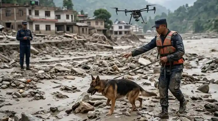
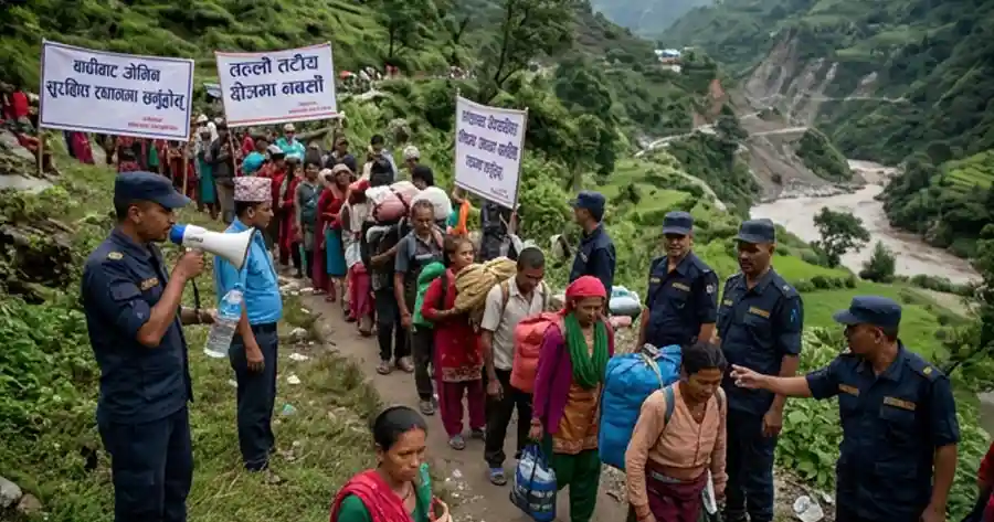
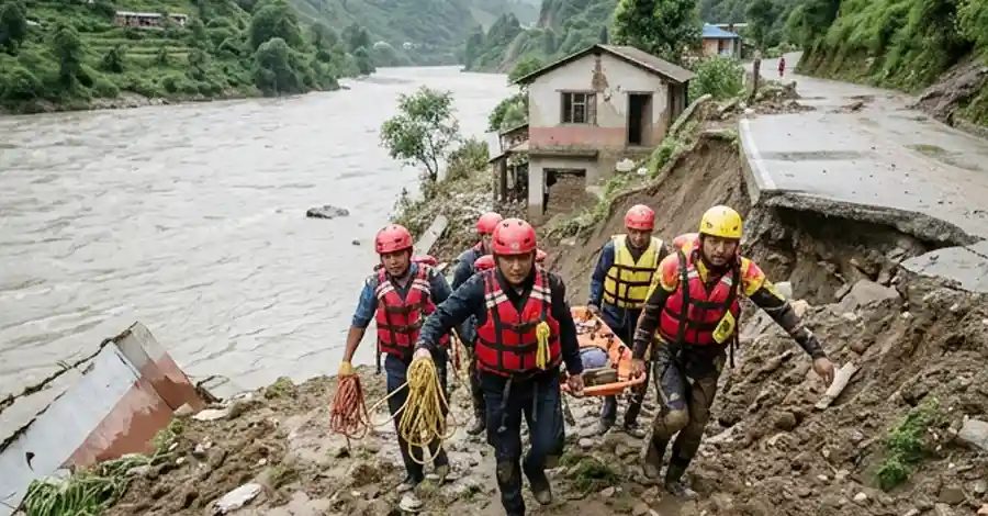
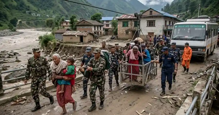
The human cost of the Rasuwa flash flood has climbed steadily as search-and-rescue operations continue. As of the most recent tallies, Nepali authorities have confirmed more than 1,050 deaths and nearly 3,916 people still missing within Nepal, with an additional 16 confirmed dead and 546 missing across the border in the Tibet Autonomous Region of China. Hundreds of migrant laborers, hydropower workers, customs staff, and local residents remain unaccounted for, and rescue crews — including specialized Indian “rat-hole” mining teams — have been deployed to reach workers trapped in flooded hydropower tunnels.
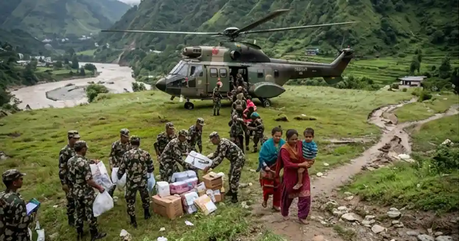
The Nepal government has declared 15 municipalities across the affected districts as disaster-crisis zones for three months, according to the World Health Organization’s Nepal office, which is coordinating emergency medical and public health support alongside the Nepal Army, Nepal Police, and Armed Police Force.
Economic and Infrastructure Fallout
Hydropower, Highways and a Dry Port Wiped Out
The Rasuwa flash flood did not just kill people; it gutted a strategically vital economic corridor in a matter of minutes. Nineteen bridges and roughly 40 kilometers of highway along the Trishuli corridor were destroyed or damaged. More than 430 megawatts of hydropower generation capacity — over 10 percent of Nepal’s entire national electricity grid — was knocked offline as multiple hydropower projects were buried under debris.
Among the casualties was a dry port built at a cost of roughly 2.8 billion Nepali rupees, along with a 25-megawatt solar power plant in Nuwakot, both effectively entombed under mud and rock. Nepal’s main overland trade and customs gateway with China, a critical artery for imports and cross-border commerce, was rendered non-functional overnight.
Economists warn the disaster lands a direct blow to an economy that was already limping along with growth of roughly 2.3 percent. Rebuilding this corridor is expected to force budget reallocations away from planned development spending and add further pressure to Nepal’s public debt.
Why This Flood Is a National Security Issue, Not Just a Natural Disaster
Nepal’s traditional definition of national security has long centered on border security personnel, weapons, foreign military threats, diplomacy, and internal conflict. Environmental hazards are technically acknowledged in Nepal’s National Security Policy as a “non-traditional security threat,” but in practice, that recognition rarely moves beyond the disaster-relief mandate of the Ministry of Home Affairs or the routine forestry programs of the Ministry of Forests. It almost never reaches the strategic planning table of the National Security Council.
The Rasuwa flash flood argues powerfully for a rethink. No foreign missile, artillery shell, or invading army destroyed Nepal’s primary trade gateway with China. A mountainside did it — in less than half an hour, without warning, and largely without any dedicated monitoring system in place to detect it coming.
Lessons from Switzerland, India and Pakistan
Other mountainous nations have already folded high-altitude glacial and permafrost monitoring into their formal security architecture. Switzerland’s Federal Department of Defence, Civil Protection and Sport oversees Swiss Armed Forces and civil-protection units that treat Alpine glacier and permafrost stability as a strategic risk category, with military engineering commands using satellite radar to continuously monitor high-mountain infrastructure.
India, rather than building an entirely new agency, restructured and merged two long-established defense research bodies — the Snow and Avalanche Study Establishment and the Defence Terrain Research Laboratory — into a unified Defence Geoinformatics Research Establishment, directly linking snow avalanche, terrain, and glacial-lake monitoring in its border regions to national military defense planning. Pakistan similarly routes this kind of monitoring through its space agency.
Nepal currently has no comparable institution. Yet the technology required is neither exotic nor classified. Satellite radar sensors, unlike ordinary optical satellite cameras, can see through the thick monsoon cloud cover that regularly blankets the Himalayas, detecting ground deformation and slope instability well before a catastrophic failure. This technology is openly and commercially available today.
Nepal’s Glacial Lakes: A Ticking Time Bomb
The Rasuwa disaster was technically not a classic GLOF — it was an ice-rock avalanche and debris flow that temporarily dammed a river, a distinct but related hazard within the broader category of cryosphere disasters, as explained by mountain-hazard researchers writing for eKuhipath. But the underlying driver — a warming, destabilizing high mountain environment — is the same force behind Nepal’s genuine glacial lake risk.
Nepal is home to more than 2,000 glacial lakes at high altitude. Of these, ICIMOD’s research has flagged 21 as carrying a high risk of sudden outburst. Looking beyond Nepal’s borders, a further 47 glacial lakes are considered high-risk — 46 on the Tibetan side and one in India — any of which could fail with little warning and send floodwaters cascading into Nepali valleys.
This is not a hypothetical concern confined to one bad year. In 2023, a very similar mechanism devastated Sikkim, India, when thawing permafrost triggered a rock collapse into South Lhonak Lake, unleashing an outburst flood of more than 50 million cubic meters of water that damaged over 25,000 buildings and more than 30 bridges, according to research summarized by The Conversation. Nepal itself experienced a smaller but no less devastating glacial lake outburst flood in Thame village in the Everest region in August 2024, and a glacial lake burst in Humla’s remote Tilgau village in May 2025.
Research from the Third Pole region — encompassing the Tibetan Plateau, the Himalayas, the Hindu Kush, and the Tianshan mountains — shows that glacial lake outburst flood frequency has been on a significant upward trend since 1980, with especially intensified activity along the China–Nepal border over the past decade. ICIMOD’s broader 2026 cryosphere assessment further notes that ice loss across the Hindu Kush Himalaya region has roughly doubled since 2000, with glacier area shrinking by about 12 percent between 1990 and 2020 — a warming trend directly implicated in this year’s Rasuwa catastrophe.
Nepal’s Fragile Geology Makes the Risk Worse
Nepal’s mountains were never geologically stable to begin with. As one of the world’s youngest mountain ranges, the Himalayas are naturally prone to regular landslides and flash floods. The devastating 2015 earthquake further loosened and fractured the interior structure of Nepal’s hillsides, leaving slopes more vulnerable to sudden failure. Add to that widespread unregulated excavation, quarrying, and road-cutting across fragile hill terrain, and Nepal’s mountains face a genuinely dangerous convergence of natural and human-driven instability. Climate change compounds all of it, warming permafrost and accelerating glacier melt at elevations where temperature had, for centuries, been reliably subzero.
Meanwhile, Nepal’s lowland Terai belt faces its own recurring flood crisis nearly every monsoon season, showing that this is not a single-valley problem but a nationwide vulnerability spanning from the highest Himalayan peaks down to the plains bordering India.
What Nepal Must Do Next: Building a Cryosphere-Ready Security System
Security analysts and glaciologists argue that Nepal needs concrete, structural changes — not just improved disaster response after the fact. Several concrete steps are being proposed:
- Establish a dedicated Cryosphere and Multi-Hazard Security Desk within Nepal’s National Security Council, staffed permanently by hydrologists, geologists, glaciologists, and geospatial data analysts, rather than treating this expertise as an occasional consultative resource.
- Equip the Nepal Army and Armed Police Force’s disaster-management units with genuine geospatial intelligence capability, including the ability to analyze InSAR (interferometric synthetic aperture radar), LiDAR, and satellite radar data for early detection of slope instability and glacier movement.
- Mandate permafrost-safety and seismic-risk audits across entire river basins before greenlighting hydropower or other strategic infrastructure projects, replacing the older practice of assessing only the visible river water level at a proposed dam site.
- Formalize real-time satellite and hydro-meteorological data sharing between Nepal and China as a binding bilateral security protocol, not an informal or ad hoc arrangement, given that this disaster originated on the Nepal side of the border but the initial CCTV footage of impact came from the Chinese Gyirong checkpoint within minutes of collapse.
- Invest in impact-based early warning systems. As ICIMOD researchers have pointed out in interviews following the disaster, regional cooperation and investment in robust early-warning infrastructure are essential given how unpredictable high-altitude weather and rapid glacial melt compound risk in this region.
Regional academic literature backs this direction: peer-reviewed hazard modeling published in Natural Hazards and Earth System Sciences has specifically flagged transboundary Himalayan river basins — exactly the kind that connects Nepal, Tibet, and India along the Trishuli-Narayani system — as facing escalating glacial lake outburst flood risk as new lakes continue to form.
Climate Justice: Who Really Pays for a 0.1% Emitter’s Disaster
Perhaps the most uncomfortable dimension of the Rasuwa flash flood is the question of responsibility. Nepal contributes less than 0.1 percent of global greenhouse gas emissions, yet it is absorbing some of the most severe physical consequences of a warming planet, a pattern researchers and scientists quoted by outlets including Reuters and the BBC have connected directly to climate change’s role in destabilizing high-altitude glaciers and permafrost.
The financial burden of rebuilding falls squarely on Nepal’s own shoulders: a shrinking development budget, new borrowing, and years of reconstruction spending redirected away from schools, health care, and other priorities — the price of an emissions crisis Nepal did almost nothing to create.
Conclusion: From Environmental Tragedy to National Security Priority
The Rasuwa flash flood of August 2026 should not be remembered only as a tragic natural disaster with a rising death toll. It is a warning shot from Nepal’s own mountains, proof that a warming Himalaya can inflict, in half an hour, damage comparable to a military strike on critical national infrastructure — without a single foreign soldier crossing the border.
Nepal’s mountains hold thousands of glacial lakes and unstable slopes that scientists have already flagged as dangerous. The technology to monitor them exists and is commercially accessible today. What has been missing is the political will to treat glaciology not as an academic curiosity confined to university research departments, but as the first line of defense for a nation whose economy, infrastructure, and citizens increasingly live in the shadow of an unstable high mountain environment.
Whether Nepal integrates cryosphere science into its national security doctrine before the next collapse, or only after it, will determine how many more Rasuwa-scale tragedies the country is forced to endure.

Economic Affair
- Budhigandaki Flood: 47 Rescued as Bridges Washed Away
- Nepal Supreme Court Handcuff Order: Police Barred From Routine Use
- 250+ Officials Deploy to Assess Rasuwa-Bhotekoshi Flood Damage
- Electricity VAT: Energy and Finance Ministers Strike Landmark Deal After Just 2 Months
- Nepal Inflation Shockingly Triples to 5.96% — Food and Transport Hit Hardest


Comments